We discovered a new trail last week and spent a little time on Monday afternoon hiking the first 7 km. Plus 6km to loop back to the start.
The Avon Trail runs from St. Marys to Conestogo. Follow the link to the club website. I found the site to be a little bit lacking in details – possibly because they want you to purchase the map set that is the trail guide. I didn’t find anywhere on the site that would tell me where to find the trail head.
We also discovered that the address for St. Marys Tourism is 175 Queen St. E which is just a little different from what the site lists as a location to purchase the trail guide. But we persevered and found the office and handed over $15 cash ( no debit) to get the guide.
That said, the guide was a very nice set of 6 detailed maps and an overview map that explained the trail in good detail.
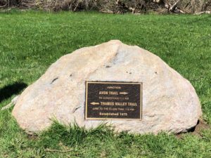 We headed back to the trail head by the tennis courts on Water St. There is ample parking and the large rock marking the point where the Thames Valley trail and the Avon Trail meet is clearly labeled with a nice plaque.
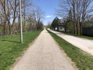 The first 2 kilometers of the trail are along the river in St. Marys. It’s a very pleasant walk and easily accessible for all levels.
At about the 2 km mark the trail climbs up to a section of rail trail near the north edge of town.
 If you are just looking for a short but pleasant walk then this is a great place to turn back.
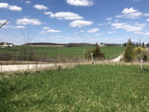
From here you work your way out of town. First on the rail trail and then on relatively quiet country roads. We continued on to the corner of Glass St. and 14th line which is 4.9 km. 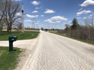
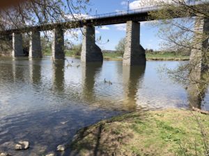
Since there is no parking available at that location and we wanted to be able to come back and continue again another day we pushed on to the corner of 14th line and road 122 which is 7 km along the trail. That section of 14th is a very quiet gravel road that leads through a valley and crosses over Trout Creek.
 From there we left the trail and went down road 122 to line 9 which turns into Queen St. as you enter St. Marys from the east. Exiting the trail here left us with 6 km to get back to car. Line 9 is a bit busier but the shoulders are wide so it isn’t to bad for walking along.
As you come back into St. Marys you will see the old water tower on the left at the corner of Queen and James St. We continued down Queen St. until we reached the river and then followed the walkway back to the trail head.
Including a couple of breaks for lunch and water it took 3 hours 25 minutes to walk the 13 km. If you are seeking rugged wilderness this isn’t the trail for you but if you are looking for a very nice walk in the southern Ontario countryside then check out the Avon Trail.